
Application potential of remote sensing for developing countries
- Project team:
Katrin Gerlinger (Projektleitung)
- Thematic area:
- Topic initiative:
Commitee on Economic Cooperation and Development
- Analytical approach:
TA project
- Startdate:
2010
- Enddate:
2012
sprungmarken_marker_2012
Background and central aspects of the topic
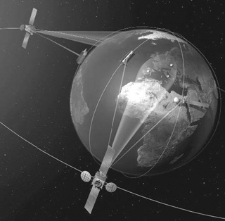
Remote sensing (of the Earth) comprises techniques which serve to record data about the condition of the Earth's surface. Sensors are used to record the electromagnetic radiation (including visible light, infrared) emitted from the Earth's surface. Remote sensors can be carried by aeroplanes ("aerial images") and satellites ("satellite images"). The civil use of satellite images for remote sensing of the Earth has been widely employed since the 1970s, and the use of aerial images goes back several decades further.
The advantages of remote sensing data lie on the one hand in their extensive availability: even those areas of the Earth's surface that are hard to access can be charted with the aid of aerial and satellite images. In addition, Earth observation satellites usually fly over the same areas of the Earth's surface again within a few days, allowing the data to be kept very much up to date. And finally, remote sensing data are characterised by their comparatively low costs (per unit of charted area).
Accordingly, remote sensing data have been used for many years for numerous applications. In principle, this could centre on two types of application: on the one hand, recording the status quo of the Earth's surface (charting), on the other hand recording its changes (monitoring). Use of the data primarily involves documentation of certain phenomena or generating a basis for decision making.
In addition to military use for reconnaissance purposes, several fields of application can be named in the civil sector:
- Resource management in agriculture, forestry and fishery: for instance, preparing land use inventories and harvest predictions, use of precision agriculture techniques, estimating timber potential, charting forest damage, monitoring deforestation and forest fires.
- Exploration of raw material deposits
- Obtaining environmental information: for instance documenting ground changes (soil sealing, erosion, desertification), contamination of air and water, effects of climate change.
- Urban development: for instance, charting settlement areas (particularly in towns with uncontrolled growth)
- Catastrophe management: Monitoring natural hazards (in areas endangered by flooding, drought, earthquakes or volcanic eruptions); and here, risk analysis, monitoring, supporting the action force, analysing catastrophic events.
The above-mentioned advantages and the many areas of application of remote sensing data strongly suggest there is also a great potential for developing countries in terms of using these techniques, since the advantages (e.g., recording data about inaccessible areas, lack of alternative sources for primary data) are particularly important here.
Particularly in the 1980s and until the beginning of the 1990s, the potential use of remote sensing for developing countries was an important subject of research in the industrial countries (including activities on the part of the GTZ and FAO). Comprehensive studies on the topic also exist from this period. In the following years, interest in the topic reduced significantly; however, still today, some researchers - in Germany too - are giving consideration to possible uses in developing countries (esp. the special interest group »Developing Countries« from the European Association of Remote Sensing Laboratories EARSeL).
It can be assumed that technical development in the field of data acquisition (sensors) as well as in the area of data analysis (Geographic Information Systems, GIS) will extend the application options of remote sensing in developing countries still further in the near future. Moreover, the above-mentioned fields will in all probability gain further in importance due to increasing social (urban development) and ecological problems (desertification, erosion and others) in developing countries.
Objectives and approach
The aim of the project is to determine the current status of remote sensing technology and its use in developing countries, as well as to outline emerging future applications. This seems reasonable particularly since there has been no comprehensive investigation and presentation on this topic for many years, although the possible uses have further devel-oped considerably.
In addition, the project aims to collate information on the attempts at »technology transfer", which often failed in the past, in order to build upon this to identify possible conditions for a successful and solution-orientated future use of remote sensing techniques in developing countries. In the past, the political and social conditions and consequences of introducing remote sensing techniques were scarcely treated. An in-depth investigation into this aspect of the topic is thus central. The investigation should also cover the extent to which there are currently preconditions on infrastructure and personnel for a self-determined use of remote sensing data in developing countries and which measures could be taken in this regard. A further question pertains to whether new dependencies are created between industrial countries and developing ones as a result of more intensive recording and analysis of remote sensing data, or how these could be avoided.
Publications
Gerlinger, K.
2013. TAB-Brief, (42), 11–18
Gerlinger, K.
2013, December. Büro für Technikfolgen-Abschätzung beim Deutschen Bundestag (TAB)
Gerlinger, K.
2013, December. Büro für Technikfolgen-Abschätzung beim Deutschen Bundestag (TAB)
Gerlinger, K.
2012. Büro für Technikfolgen-Abschätzung beim Deutschen Bundestag (TAB). doi:10.5445/IR/310094848
In the Bundestag
- Vorgang - Bericht, Gutachten, Programm im Dokumentations- und Informationssystem für Parlamentsmaterialien (DIP)